9. NSW LandXML - Export to LandXML File
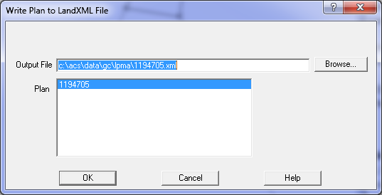
Use the Conversions/LandXML/Write Plan to LandXML option.
Select the required output filename, and select the plan to be exported from the list.
During this process the program will export all the points, parcels and lines to the LandXML file.
Note: When writing adjoining parcels, the program detects all L or U strings with common points
to the plan. It will only export Visible strings, so if you have any adjoining strings which
should not be included (e.g. a future subdivision stage), make them non visible before using
this option.
Check the LandXML File
Use the Conversions/LandXML/Write Plan to LandXML file option. Select the required plan,
set the export filename and press OK to export the file.
You can edit the file with any text editor. See Text Editors.
Do not edit it with Microsoft Word!!!!
You can also view the file by double clicking it and it will display in Internet Explorer.
You can check the validity of the LandXML file by starting a new job in GeoCadastre or GeoSurvey
and importing it using Conversions/LandXML/Read LandXML File.
Select the ''NSW LandXML ePlan' option and read in the file.
This will perform extensive checking on the data fields to make sure all required data is present.
Check the LandXML file using the SIX Portal
The LandXML file can be checked by use of routines available from the SIX portal.
These checks are in two forms.
The first will analyse the LandXML file check syntax and content as well as carrying out
various mathematical checks. It really replicates a lot of the standard processes used in the plan
checking process.
The second process will generate a subdivision plan directly from the LandXML file.
This software will also be used to generate the official plan of the data, so the generated plan
should be kept as your copy of the job.
Processing Steps
Overview
1. Initial Setup - Config File
2. Create the Plan heading Information
3. Integration Survey Marks
4. Point Data
5. Plan Data
6. Parcel Data
7. Editing Parcels and Lines
8. Occupations
9. Export to LandXML file